Kampung Enam topographic map
Interactive map
Click on the map to display elevation.
About this map
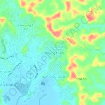
Name: Kampung Enam topographic map, elevation, terrain.
Average elevation: 24 m
Minimum elevation: -1 m
Maximum elevation: 77 m

Click on the map to display elevation.
Name: Kampung Enam topographic map, elevation, terrain.
Average elevation: 24 m
Minimum elevation: -1 m
Maximum elevation: 77 m