Geolocate

Peoga topographic map

Click on the map to display elevation.

About this map

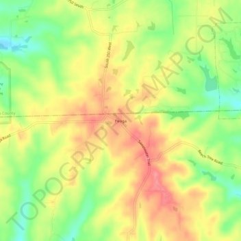
Name: Peoga topographic map, elevation, terrain.

Location: Peoga, Brown County, Indiana, 46164, United States (39.32311 -86.16416 39.36311 -86.12416)

Average elevation: 280 m

Minimum elevation: 236 m

Maximum elevation: 317 m

Gear up for your next adventure:

🥾Approach Boots - Comfortable boots for hiking and climbing approaches
🏕️Camping Hammock - Integrated protection for sleeping between trees
🥤Collapsible Travel Cup - Saves space and weight in your mess kit
🔥Emergency Fire Starter - Reliable ignition source for all weather conditions
🕶️Polarized Sunglasses - Reduces glare from snow and water at high elevations

As an Amazon Associate, this site earns from qualifying purchases at no extra cost to you.