
Oteros topographic map
Interactive map
Click on the map to display elevation.
About this map
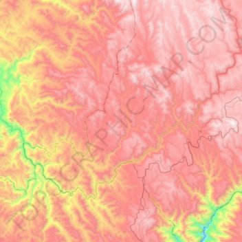
Name: Oteros topographic map, elevation, terrain.
Location: Oteros, Bocoyna, Chihuahua, México (27.58597 -108.00438 27.76040 -107.69989)
Average elevation: 2,150 m
Minimum elevation: 1,214 m
Maximum elevation: 2,644 m
Other topographic maps
Click on a map to view its topography, its elevation and its terrain.