Geolocate

Taide topographic map

Click on the map to display elevation.

About this map

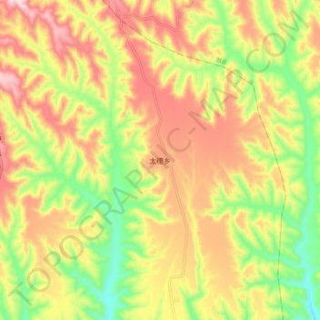
Name: Taide topographic map, elevation, terrain.

Location: Taide, Daning County, Linfen, Shanxi, China (36.50500 110.75700 36.58500 110.83700)

Average elevation: 979 m

Minimum elevation: 776 m

Maximum elevation: 1,177 m

Gear up for your next adventure:

🥾Trekking Poles - Adjustable trekking poles to reduce knee stress and improve stability
💧Reusable Water Bottle - Durable water bottles for hydration on trails
🥾Hiking Shoes - Durable and comfortable shoes for trail hiking
🥾Waterproof Trail Shoes - Shoes designed to handle wet terrain
👟Sport Hiking Sandals - Breathable footwear for water crossings and camp rest

As an Amazon Associate, this site earns from qualifying purchases at no extra cost to you.