Geolocate

Al-Obour topographic map

Click on the map to display elevation.

About this map
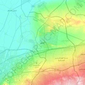
Name: Al-Obour topographic map, elevation, terrain.

Location: Al-Obour, Al Qalyubiya, 11785, Egypt (30.03140 31.29055 30.35140 31.61055)

Average elevation: 98 m

Minimum elevation: 2 m

Maximum elevation: 366 m

Other topographic maps

Click on a map to view its topography, its elevation and its terrain.

El Obour

Egypt > Al Qalyubiya

Average elevation: 78 m

Bahada

Egypt > Al Qalyubiya

Average elevation: 16 m

Akyad Digawy

Egypt > Al Qalyubiya

Average elevation: 15 m

Al Salam First

Egypt > Al Qalyubiya

Average elevation: 31 m

Gear up for your next adventure:

🧥Thermal Fleece Jacket - Versatile insulation for changing mountain temperatures
🥾Hiking Shoes - Durable and comfortable shoes for trail hiking
🦟Insect Repellent - Keep mosquitoes and black flies away in wooded areas
🌬️Windproof Camp Stove - Efficient cooking even on exposed mountain peaks
🚑Survival Whistle - Signal for help across long distances in mountains

As an Amazon Associate, this site earns from qualifying purchases at no extra cost to you.