
Cibeusi topographic map
Click on the map to display elevation.
About this map
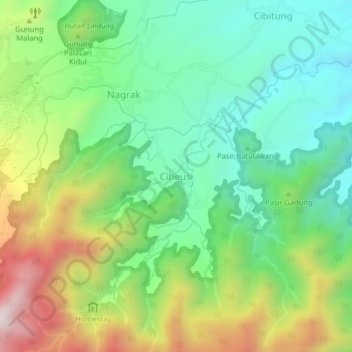
Name: Cibeusi topographic map, elevation, terrain.
Location: Cibeusi, Subang, West Java, Java, 41281, Indonesia (-6.76715 107.65601 -6.72715 107.69601)
Average elevation: 912 m
Minimum elevation: 637 m
Maximum elevation: 1,412 m
Other topographic maps
Click on a map to view its topography, its elevation and its terrain.
PT.Sinkona Lestari Indoesia Backyard Park
Indonesia > West Java > Subang > Subang
Average elevation: 744 m