
Thank you for supporting this site ❤️
Make a donation
Make a donation
Gear up for your next adventure:
As an Amazon Associate, this site earns from qualifying purchases at no extra cost to you.
İbrahimli topographic map
Click on the map to display elevation.
Thank you for supporting this site ❤️
Make a donation
Make a donation
Gear up for your next adventure:
As an Amazon Associate, this site earns from qualifying purchases at no extra cost to you.
About this map
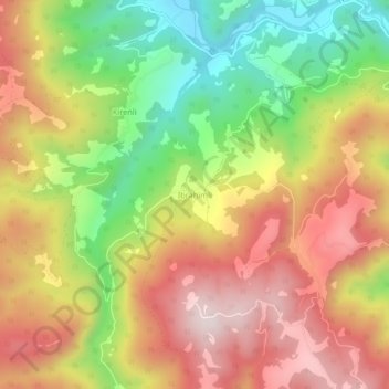
Name: İbrahimli topographic map, elevation, terrain.
Location: İbrahimli, Kastamonu, Black Sea Region, Turkey (41.27436 34.05081 41.31436 34.09081)
Average elevation: 1,244 m
Minimum elevation: 904 m
Maximum elevation: 1,556 m
Thank you for supporting this site ❤️
Make a donation
Make a donation
Gear up for your next adventure:
As an Amazon Associate, this site earns from qualifying purchases at no extra cost to you.