Geolocate

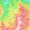
Gevoudaz topographic map

Click on the map to display elevation.

About this map

Name: Gevoudaz topographic map, elevation, terrain.

Location: Gevoudaz, Albiez-le-Vieux, Albiez-Montrond, Saint-Jean-de-Maurienne, Savoie, Auvergne-Rhône-Alpes, France métropolitaine, 73300, France (45.21088 6.29444 45.25088 6.33444)

Average elevation: 1,229 m

Minimum elevation: 663 m

Maximum elevation: 2,188 m

Other topographic maps

Click on a map to view its topography, its elevation and its terrain.
Montrond

France > Auvergne-Rhône-Alpes > Savoie > Albiez-Montrond

Average elevation: 2,048 m

Gear up for your next adventure:

🥾Trail Hiking Shoes - Durable shoes designed for rugged trails
🔦UV Flashlight - Detect minerals or specific insects in the dark
🧼Travel Hand Sanitizer - Keep hands clean when water is scarce
🧥Insulated Jacket - Keep warm in cold outdoor conditions
🥾Mountain Hiking Boots - High-traction boots for rocky terrain

As an Amazon Associate, this site earns from qualifying purchases at no extra cost to you.