Geolocate

Riceboro topographic map

Click on the map to display elevation.

About this map

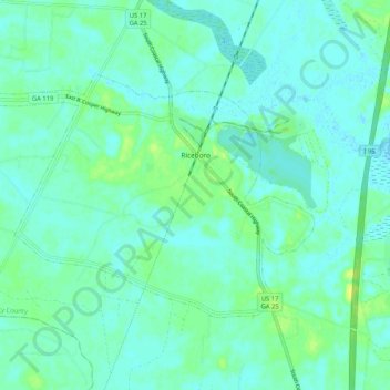
Name: Riceboro topographic map, elevation, terrain.

Location: Riceboro, Liberty County, Georgia, 31323, United States (31.69864 -81.50585 31.75403 -81.40184)

Average elevation: 5 m

Minimum elevation: -2 m

Maximum elevation: 19 m

Other topographic maps

Click on a map to view its topography, its elevation and its terrain.

Fleming

United States > Georgia > Liberty County

Average elevation: 5 m

Seabrook

United States > Georgia > Liberty County

Average elevation: 7 m

Gear up for your next adventure:

🔨Vehicle Emergency Tool - Safety tool for remote road trips to trailheads
🧭GPS Tracker - Track your location in remote areas safely
🦶Hiking Shoe Insoles - Added support for high arches and long days on feet
🪑Ultralight Camping Stool - Compact seating for rest stops during long hikes
👟Trail Running Shoes - Agile footwear for fast-paced topographic exploration

As an Amazon Associate, this site earns from qualifying purchases at no extra cost to you.