Geolocate

Mapanget topographic map

Click on the map to display elevation.

About this map
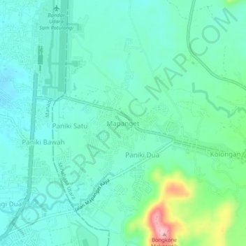
Name: Mapanget topographic map, elevation, terrain.

Location: Mapanget, Minahasa Utara, North Sulawesi, Sulawesi, 95370, Indonesia (1.51164 124.91603 1.55164 124.95603)

Average elevation: 99 m

Minimum elevation: 60 m

Maximum elevation: 240 m

Other topographic maps

Click on a map to view its topography, its elevation and its terrain.

Gear up for your next adventure:

🧰Survival Kit - Essential gear for emergencies in the wilderness
💧Filtered Water Bottle - Safe drinking water on the go
🧥Waterproof Hiking Jacket - Protect yourself from rain and wind while hiking
🧢Sun Hat - Wide-brim hat for sun protection
🎒Fully Waterproof Backpack - Total protection for photography gear and electronics

As an Amazon Associate, this site earns from qualifying purchases at no extra cost to you.