Geolocate

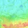
Esterwegen topographic map

Click on the map to display elevation.

About this map

Name: Esterwegen topographic map, elevation, terrain.

Location: Esterwegen, Samtgemeinde Nordhümmling, Landkreis Emsland, Nedersaksen, 26897, Duitsland (52.95481 7.56502 53.05148 7.71270)

Average elevation: 10 m

Minimum elevation: 3 m

Maximum elevation: 40 m

Other topographic maps

Click on a map to view its topography, its elevation and its terrain.

Gleesen

Duitsland > Nedersaksen > Landkreis Emsland

Average elevation: 29 m

Neusustrum

Duitsland > Nedersaksen > Landkreis Emsland

Average elevation: 11 m

Hesselte

Duitsland > Nedersaksen > Landkreis Emsland > Emsbüren

Average elevation: 31 m

Sprakel

Duitsland > Nedersaksen > Landkreis Emsland > Stavern

Average elevation: 39 m

Sand

Duitsland > Nedersaksen > Landkreis Emsland > Oberlangen

Average elevation: 10 m

Haar

Duitsland > Nedersaksen > Landkreis Emsland > Haren (Ems)

Average elevation: 15 m

Gear up for your next adventure:

🧥Thermal Layer - Insulating layer for cold outdoor conditions
🥾Trekking Poles - Adjustable trekking poles to reduce knee stress and improve stability
👖Convertible Hiking Pants - Zip-off legs to adapt to changing weather conditions
🚑Survival Whistle - Signal for help across long distances in mountains
🧰Multitool Knife - Compact and versatile tool for outdoor use

As an Amazon Associate, this site earns from qualifying purchases at no extra cost to you.