Geolocate

Canal topographic map

Click on the map to display elevation.

About this map

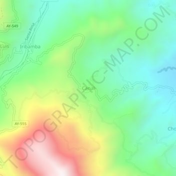
Name: Canal topographic map, elevation, terrain.

Location: Canal, Samugari, La Mar, Ayacucho, Perú (-12.78276 -73.70670 -12.74276 -73.66670)

Average elevation: 1,107 m

Minimum elevation: 737 m

Maximum elevation: 1,792 m

Gear up for your next adventure:

🏕️Camping Hammock - Integrated protection for sleeping between trees
🚲Handlebar Phone Mount - View topographic-map.com live while cycling
🧥Waterproof Hiking Jacket - Protect yourself from rain and wind while hiking
💡LED Camping Lantern - Illuminate your campsite with long-lasting lanterns
🧢Outdoor Visor - Breathable visor for sunny hikes

As an Amazon Associate, this site earns from qualifying purchases at no extra cost to you.