
Thank you for supporting this site ❤️
Make a donation
Make a donation
Gear up for your next adventure:
As an Amazon Associate, this site earns from qualifying purchases at no extra cost to you.
Hanamur topographic map
Click on the map to display elevation.
Thank you for supporting this site ❤️
Make a donation
Make a donation
Gear up for your next adventure:
As an Amazon Associate, this site earns from qualifying purchases at no extra cost to you.
About this map
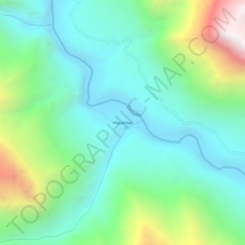
Name: Hanamur topographic map, elevation, terrain.
Location: Hanamur, Zanskar tehsil, Distrikt Kargil, Ladakh, Indien (33.69900 76.85044 33.73900 76.89044)
Average elevation: 3,801 m
Minimum elevation: 3,364 m
Maximum elevation: 4,996 m
Thank you for supporting this site ❤️
Make a donation
Make a donation
Gear up for your next adventure:
As an Amazon Associate, this site earns from qualifying purchases at no extra cost to you.