Geolocate

Talagang topographic map

Click on the map to display elevation.

About this map
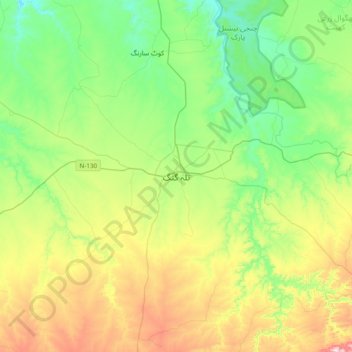
Name: Talagang topographic map, elevation, terrain.

Location: Talagang, Talagang Tehsil, Talagang District, Punjab, Pakistan (32.76351 72.25398 33.08351 72.57398)

Average elevation: 476 m

Minimum elevation: 313 m

Maximum elevation: 818 m

Gear up for your next adventure:

🥾Waterproof Hiking Shoes - Durable shoes for wet and rugged trails
👟Trail Running Shoes - Agile footwear for fast-paced topographic exploration
🚑Survival Whistle - Signal for help across long distances in mountains
🛌Insulated Sleeping Pad - Critical thermal barrier between you and the cold ground
🧦Merino Wool Socks - Moisture-wicking comfort for long-distance hiking

As an Amazon Associate, this site earns from qualifying purchases at no extra cost to you.