
Thank you for supporting this site ❤️
Make a donation
Make a donation
Gear up for your next adventure:
As an Amazon Associate, this site earns from qualifying purchases at no extra cost to you.
Sulzberg topographic map
Click on the map to display elevation.
Thank you for supporting this site ❤️
Make a donation
Make a donation
Gear up for your next adventure:
As an Amazon Associate, this site earns from qualifying purchases at no extra cost to you.
About this map
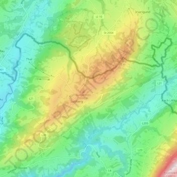
Name: Sulzberg topographic map, elevation, terrain.
Location: Sulzberg, Bezirk Bregenz, Vorarlberg, 6934, Austria (47.50242 9.86249 47.54815 9.97129)
Average elevation: 758 m
Minimum elevation: 521 m
Maximum elevation: 1,230 m
Thank you for supporting this site ❤️
Make a donation
Make a donation
Gear up for your next adventure:
As an Amazon Associate, this site earns from qualifying purchases at no extra cost to you.