Geolocate

Berkheim topographic map

Click on the map to display elevation.

About this map

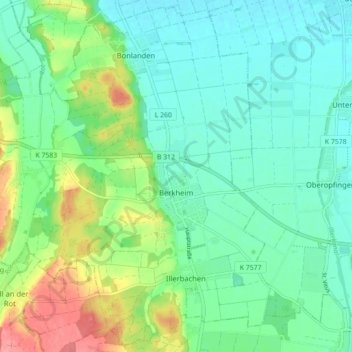
Name: Berkheim topographic map, elevation, terrain.

Location: Berkheim, Gemeindeverwaltungsverband Illertal, Landkreis Biberach, Baden-Württemberg, 88450, Germany (48.01831 10.01875 48.07496 10.10684)

Average elevation: 579 m

Minimum elevation: 554 m

Maximum elevation: 640 m

Other topographic maps

Click on a map to view its topography, its elevation and its terrain.

Gear up for your next adventure:

🥾Trail Hiking Shoes - Durable shoes designed for rugged trails
🔪Outdoor Multitool - Versatile tool for repairs and food prep in the wild
🔭Compact Binoculars - Lightweight optics for scouting trails and wildlife
🧣Evaporative Cooling Towel - Beat the heat during intense summer climbs
🚲MTB Frame Bag - Carry tools and maps directly on your bicycle frame

As an Amazon Associate, this site earns from qualifying purchases at no extra cost to you.