Geolocate

Suplang topographic map

Click on the map to display elevation.

About this map

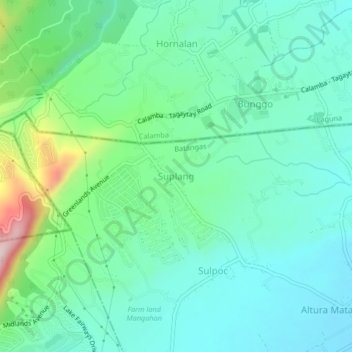
Name: Suplang topographic map, elevation, terrain.

Location: Suplang, Tanauan, Batangas, Calabarzon, 4232, Philippines (14.12968 121.04370 14.16968 121.08370)

Average elevation: 249 m

Minimum elevation: 169 m

Maximum elevation: 509 m

Gear up for your next adventure:

🥾Trekking Poles - Adjustable trekking poles to reduce knee stress and improve stability
🛌Down Sleeping Bag - Superior warmth-to-weight ratio for cold nights
🧣Evaporative Cooling Towel - Beat the heat during intense summer climbs
🌡️Emergency Mylar Blankets - Compact thermal protection for unexpected nights outdoors
🧶550 Survival Paracord - Versatile utility cord for emergency repairs and rigging

As an Amazon Associate, this site earns from qualifying purchases at no extra cost to you.