
Niani topographic map
Interactive map
Click on the map to display elevation.
About this map
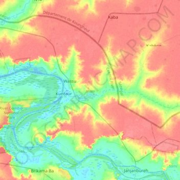
Name: Niani topographic map, elevation, terrain.
Location: Niani, Kuntaur, Division de Central River, Gambie (13.54791 -15.04327 13.80547 -14.72438)
Average elevation: 28 m
Minimum elevation: -1 m
Maximum elevation: 53 m
Other topographic maps
Click on a map to view its topography, its elevation and its terrain.
Kaur
Gambie > Division de Central River > Kaur
Kaur, Lower Saloum, Kuntaur, Division de Central River, Gambie
Average elevation: 9 m