
Kaunertal topographic map
Interactive map
Click on the map to display elevation.
About this map
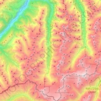
Name: Kaunertal topographic map, elevation, terrain.
Location: Kaunertal, Bezirk Landeck, 6524, Autriche (46.82251 10.66156 47.07185 10.82162)
Average elevation: 2,399 m
Minimum elevation: 869 m
Maximum elevation: 3,726 m
Other topographic maps
Click on a map to view its topography, its elevation and its terrain.
Platz
Autriche > Bezirk Landeck > Vergötschen
Platz, Vergötschen, Kaunertal, Bezirk Landeck, 6524, Autriche
Average elevation: 1,797 m
Egg
Autriche > Bezirk Landeck > Galtür
Egg, Galtür, Bezirk Landeck, 6563, Autriche
Average elevation: 2,006 m
Brand
Autriche > Bezirk Landeck > Ischgl
Brand, Ischgl, Bezirk Landeck, 6561, Autriche
Average elevation: 1,803 m