Geolocate

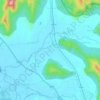
Mahad topographic map

Click on the map to display elevation.

About this map

Name: Mahad topographic map, elevation, terrain.

Location: Mahad, Khalapur Taluka, Raigad, Maharashtra, 410202, India (18.78945 73.28243 18.82945 73.32243)

Average elevation: 63 m

Minimum elevation: 41 m

Maximum elevation: 233 m

Other topographic maps

Click on a map to view its topography, its elevation and its terrain.

Morbe Dam

India > Maharashtra > Khalapur Taluka > Chowk

Average elevation: 61 m

Patalganga

India > Maharashtra > Khalapur Taluka > Jambrung

Average elevation: 95 m

Khalapur Gaon

India > Maharashtra > Khalapur Taluka

Average elevation: 66 m

Gear up for your next adventure:

🔦UV Flashlight - Detect minerals or specific insects in the dark
🧢Sun Hat - Wide-brim hat for sun protection
🍽️Titanium Camping Spork - Ultralight and indestructible eating utensil
🎒Hiking Backpack - Lightweight and ergonomic backpacks for day hikes or multi-day treks
🏃Hydration Running Vest - Carry water and maps close to your body for speed

As an Amazon Associate, this site earns from qualifying purchases at no extra cost to you.