Geolocate

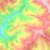
Nechasalyan topographic map

Click on the map to display elevation.

About this map

Name: Nechasalyan topographic map, elevation, terrain.

Location: Nechasalyan, Solukhumbu, Koshi Province, Nepal (27.33432 86.62000 27.37432 86.66000)

Average elevation: 1,427 m

Minimum elevation: 689 m

Maximum elevation: 2,078 m

Other topographic maps

Click on a map to view its topography, its elevation and its terrain.

Khumbupasanglahmu

Nepal > Koshi Province > Solukhumbu

Average elevation: 4,909 m

Likhupike

Nepal > Koshi Province > Solukhumbu

Average elevation: 2,755 m

Sotang

Nepal > Koshi Province > Solukhumbu

Average elevation: 2,173 m

Khumbupasanglahmu-05

Nepal > Koshi Province > Solukhumbu

Average elevation: 5,232 m

West Ridge

Nepal > Koshi Province > Solukhumbu

Average elevation: 7,035 m

Gear up for your next adventure:

🚲MTB Frame Bag - Carry tools and maps directly on your bicycle frame
🧥Insulated Jacket - Keep warm in cold outdoor conditions
🧥Waterproof Jacket - Lightweight rain jackets for hiking and outdoor activities
🪑Ultralight Camping Stool - Compact seating for rest stops during long hikes
🥾Hiking Gaiters - Protect legs and shoes from mud, snow, and debris

As an Amazon Associate, this site earns from qualifying purchases at no extra cost to you.