Geolocate

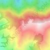
Thalisain topographic map

Click on the map to display elevation.

About this map

Name: Thalisain topographic map, elevation, terrain.

Location: Thalisain, Thailisain, Pauri Garhwal, Uttarakhand, India (30.00033 79.02986 30.04033 79.06986)

Average elevation: 1,814 m

Minimum elevation: 1,469 m

Maximum elevation: 2,534 m

Other topographic maps

Click on a map to view its topography, its elevation and its terrain.
Tarakund

India > Uttarakhand > Thailisain

Average elevation: 2,127 m

Gear up for your next adventure:

🥾Hiking Gaiters - Protect legs and shoes from mud, snow, and debris
🧴Sunscreen SPF - Broad-spectrum sunscreen for outdoor activities
🛶Canoe Life Vest - Safety vest for water sports
🚲Handlebar Phone Mount - View topographic-map.com live while cycling
🧤Insulated Winter Gloves - Heavy-duty protection for sub-zero Canadian adventures

As an Amazon Associate, this site earns from qualifying purchases at no extra cost to you.