
Make a donation
Gear up for your next adventure:
As an Amazon Associate, this site earns from qualifying purchases at no extra cost to you.
Pico de Orizaba topographic map
Click on the map to display elevation.
Make a donation
Gear up for your next adventure:
As an Amazon Associate, this site earns from qualifying purchases at no extra cost to you.
Pico de Orizaba
Pico de Orizaba, also known as Citlaltépetl (from Nahuatl citlal(in) = star, and tepētl = mountain), is an active volcano, the highest mountain in Mexico and third highest in North America, after Denali of United States and Mount Logan of Canada. Pico de Orizaba is also the highest volcano in North America. It rises 5,636 metres (18,491 ft) above sea level in the eastern end of the Trans-Mexican Volcanic Belt, on the border between the states of Veracruz and Puebla. The volcano is currently dormant but not extinct, with the last eruption taking place during the 19th century. It is the second most prominent volcanic peak in the world after Mount Kilimanjaro. Pico de Orizaba is ranked 16th by topographic isolation.
Make a donation
Gear up for your next adventure:
As an Amazon Associate, this site earns from qualifying purchases at no extra cost to you.
About this map
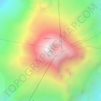
Name: Pico de Orizaba topographic map, elevation, terrain.
Location: Pico de Orizaba, Chalchicomula de Sesma, Puebla, Mexico (19.03028 -97.26987 19.03038 -97.26977)
Average elevation: 4,969 m
Minimum elevation: 4,327 m
Maximum elevation: 5,589 m
Make a donation
Gear up for your next adventure:
As an Amazon Associate, this site earns from qualifying purchases at no extra cost to you.