Geolocate

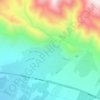
Absard topographic map

Click on the map to display elevation.

About this map

Name: Absard topographic map, elevation, terrain.

Location: Absard, Central District (Damavand County), Damavand County, Tehran Province, Iran (35.60872 52.14006 35.63080 52.16122)

Average elevation: 1,925 m

Minimum elevation: 1,846 m

Maximum elevation: 2,005 m

Other topographic maps

Click on a map to view its topography, its elevation and its terrain.

ولیران

Iran > Tehran Province > Damavand County > Damavand

Average elevation: 1,976 m

Gear up for your next adventure:

🧢Hiking Hat - Sun-protective and breathable hats for long treks
🥾Trail Running Boots - Durable shoes designed for trail running
🎒Hiking Daypack - Lightweight and durable backpacks for day trips and excursions
🔋Lithium AA Batteries - Long-lasting power that performs in extreme cold
🧭GPS Outdoor Watch - Smart watch for navigation and fitness tracking in nature

As an Amazon Associate, this site earns from qualifying purchases at no extra cost to you.