Geolocate

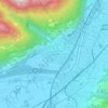
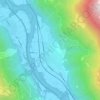
Cadenazzo topographic map

Click on the map to display elevation.

About this map

Name: Cadenazzo topographic map, elevation, terrain.

Location: Cadenazzo, Circolo di Sant’Antonino, Distretto di Bellinzona, Ticino, Switzerland (46.13070 8.91912 46.16430 8.98048)

Average elevation: 480 m

Minimum elevation: 195 m

Maximum elevation: 1,251 m

Other topographic maps

Click on a map to view its topography, its elevation and its terrain.
Claro

Switzerland > Ticino > Distretto di Bellinzona > Bellinzona

Average elevation: 565 m

Gudo

Switzerland > Ticino > Distretto di Bellinzona > Bellinzona

Average elevation: 480 m

Gear up for your next adventure:

☕Camping Coffee Maker - Brew fresh coffee anywhere on the topographic map
🧣Merino Neck Gaiter - Protects against wind, sun, and cold at high altitudes
🧣Evaporative Cooling Towel - Beat the heat during intense summer climbs
🧥Waterproof Hiking Jacket - Protect yourself from rain and wind while hiking
🥾Light Trekking Boots - Supportive boots for multi-day treks

As an Amazon Associate, this site earns from qualifying purchases at no extra cost to you.