Geolocate

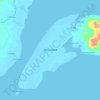
Recodo topographic map

Click on the map to display elevation.

About this map

Name: Recodo topographic map, elevation, terrain.

Location: Recodo, Zamboanga City, Zamboanga Peninsula, 7000, Philippines (6.93437 121.93981 6.97437 121.97981)

Average elevation: 9 m

Minimum elevation: 0 m

Maximum elevation: 164 m

Other topographic maps

Click on a map to view its topography, its elevation and its terrain.

Sacol Island

Philippines > Zamboanga City

Average elevation: 6 m

Vitali River

Philippines > Zamboanga City > Mangusu

Average elevation: 27 m

Sinunug Island

Philippines > Zamboanga City

Average elevation: 0 m

Plaza Pershing

Philippines > Zamboanga City

Average elevation: 4 m

Gear up for your next adventure:

💡Portable Camping Lamp - Rechargeable lamp for campsite lighting
🛶Kayak Dry Bag - Waterproof storage for kayaking adventures
🪑Ultralight Camping Stool - Compact seating for rest stops during long hikes
🥤Collapsible Travel Cup - Saves space and weight in your mess kit
🚲Bike Repair Kit - Essential tools for on-trail mechanical issues

As an Amazon Associate, this site earns from qualifying purchases at no extra cost to you.