Geolocate

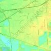
Del Paso topographic map

Click on the map to display elevation.

About this map

Name: Del Paso topographic map, elevation, terrain.

Location: Del Paso, Sacramento, Sacramento County, California, 94834, United States (38.63268 -121.49329 38.67268 -121.45329)

Average elevation: 9 m

Minimum elevation: 3 m

Maximum elevation: 16 m

Other topographic maps

Click on a map to view its topography, its elevation and its terrain.

Gear up for your next adventure:

🚲MTB Frame Bag - Carry tools and maps directly on your bicycle frame
🦟Insect Repellent - Keep mosquitoes and black flies away in wooded areas
🔭Compact Binoculars - Lightweight optics for scouting trails and wildlife
🔨Vehicle Emergency Tool - Safety tool for remote road trips to trailheads
🥾Lightweight Hiking Shoes - Comfortable shoes for day hikes

As an Amazon Associate, this site earns from qualifying purchases at no extra cost to you.