Geolocate

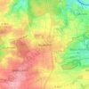
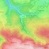
Remchingen topographic map

Click on the map to display elevation.

About this map

Name: Remchingen topographic map, elevation, terrain.

Location: Remchingen, Enzkreis, Baden-Württemberg, 75196, Germany (48.91323 8.53428 48.98989 8.61349)

Average elevation: 224 m

Minimum elevation: 139 m

Maximum elevation: 348 m

Other topographic maps

Click on a map to view its topography, its elevation and its terrain.

Niefern

Germany > Baden-Württemberg > Enzkreis

Average elevation: 310 m

Bauschlott

Germany > Baden-Württemberg > Enzkreis

Average elevation: 309 m

Göbrichen

Germany > Baden-Württemberg > Enzkreis

Average elevation: 326 m

Enzberg

Germany > Baden-Württemberg > Enzkreis > Mühlacker

Average elevation: 288 m

Gear up for your next adventure:

🧥Waterproof Jacket - Lightweight rain jackets for hiking and outdoor activities
🥾Hiking Gaiters - Protect legs and shoes from mud, snow, and debris
🥾Trail Running Shoes - Lightweight and durable shoes for trail running
🧴Insect Repellent - Protect yourself from bugs during outdoor adventures
🧦Merino Wool Socks - Moisture-wicking comfort for long-distance hiking

As an Amazon Associate, this site earns from qualifying purchases at no extra cost to you.