Geolocate

Rota topographic map

Click on the map to display elevation.

About this map
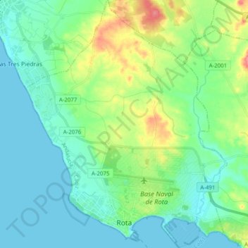
Name: Rota topographic map, elevation, terrain.

Location: Rota, Northwest Coast, Cádiz, Andalusia, 11520, Spain (36.61037 -6.42118 36.73351 -6.29615)

Average elevation: 18 m

Minimum elevation: -2 m

Maximum elevation: 71 m

Other topographic maps

Click on a map to view its topography, its elevation and its terrain.

Cerro Colón

Spain > Andalusia > Northwest Coast > Chipiona

Average elevation: 27 m

Gear up for your next adventure:

🧤Thermal Hiking Gloves - Grip-enhanced gloves for cold-weather altitude trekking
🥾Durable Hiking Shoes - Long-lasting shoes for frequent hiking
🧢Hiking Sun Hat - Wide-brimmed protection for exposed mountain ridges
🧥Waterproof Pants - Keep dry during rainy hiking conditions
🛏️Sleeping Bag - Warm and compact sleeping bags for outdoor camping

As an Amazon Associate, this site earns from qualifying purchases at no extra cost to you.