Geolocate

Rota topographic map

Click on the map to display elevation.

About this map

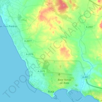
Name: Rota topographic map, elevation, terrain.

Location: Rota, Northwest Coast, Cádiz, Andalusia, 11520, Spain (36.61037 -6.42118 36.73351 -6.29615)

Average elevation: 18 m

Minimum elevation: -2 m

Maximum elevation: 71 m

Gear up for your next adventure:

🛌Down Sleeping Bag - Superior warmth-to-weight ratio for cold nights
Camping Groundsheet - Protect your tent from moisture and dirt
🥾Trail Hiking Socks - Comfortable socks to prevent blisters and fatigue
🩹Moleskin Blister Pads - Direct protection for painful foot pressure points
🔦LED Headlamp - Hands-free lighting for early morning starts or late finishes

As an Amazon Associate, this site earns from qualifying purchases at no extra cost to you.