Geolocate

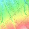
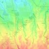
Zone 4 topographic map

Click on the map to display elevation.

About this map

Name: Zone 4 topographic map, elevation, terrain.

Location: Zone 4, Poblacion, Dasmariñas, Cavite, Calabarzon, Philippines (14.32157 120.93540 14.33058 120.94577)

Average elevation: 88 m

Minimum elevation: 62 m

Maximum elevation: 123 m

Other topographic maps

Click on a map to view its topography, its elevation and its terrain.
Mango Village

Philippines > Cavite > Dasmarinas

Average elevation: 63 m

Luksuhin Dam

Philippines > Cavite > Dasmarinas

Average elevation: 127 m

Pasong Tinta

Philippines > Cavite > Dasmarinas

Average elevation: 79 m

Piela

Philippines > Cavite > Dasmarinas > Piela

Average elevation: 170 m

Humayao

Philippines > Cavite > Dasmarinas

Average elevation: 202 m

Tibagan

Philippines > Cavite > Dasmarinas

Average elevation: 72 m

Malipay

Philippines > Cavite > Dasmarinas

Average elevation: 71 m

Gear up for your next adventure:

🥾Trail Hiking Socks - Comfortable socks to prevent blisters and fatigue
🧣Evaporative Cooling Towel - Beat the heat during intense summer climbs
🥾All-Terrain Hiking Boots - Versatile boots for varied hiking conditions
🛁Quick-Dry Microfiber Towel - Space-saving towel that dries rapidly on the move
🧼Biodegradable Camp Soap - Environmentally friendly cleaning for gear and body

As an Amazon Associate, this site earns from qualifying purchases at no extra cost to you.