Geolocate

Païta topographic map

Click on the map to display elevation.

About this map
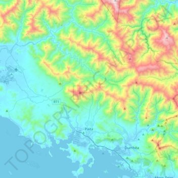
Name: Païta topographic map, elevation, terrain.

Location: Païta, South Province, New Caledonia, France (-22.22665 166.11174 -21.87992 166.47285)

Average elevation: 342 m

Minimum elevation: -2 m

Maximum elevation: 1,587 m

Other topographic maps

Click on a map to view its topography, its elevation and its terrain.

Ouipoin

France > South Province > La Foa

Average elevation: 319 m

BS4

France > South Province > Yaté

Average elevation: 201 m

BS16

France > South Province > Yaté

Average elevation: 194 m

St Maurice

France > South Province > Thio

Average elevation: 334 m

Tô De

France > South Province > Thio

Average elevation: 493 m

Gear up for your next adventure:

🧣Evaporative Cooling Towel - Beat the heat during intense summer climbs
🔨Vehicle Emergency Tool - Safety tool for remote road trips to trailheads
🏃Hydration Running Vest - Carry water and maps close to your body for speed
🏕️Camping Hammock - Integrated protection for sleeping between trees
🥾Waterproof Trail Shoes - Shoes designed to handle wet terrain

As an Amazon Associate, this site earns from qualifying purchases at no extra cost to you.