Geolocate

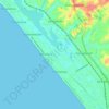
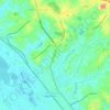
Chempazhanthy topographic map

Click on the map to display elevation.

About this map

Name: Chempazhanthy topographic map, elevation, terrain.

Location: Chempazhanthy, Thiruvananthapuram, Kerala, 695587, India (8.54727 76.89005 8.58727 76.93005)

Average elevation: 40 m

Minimum elevation: 11 m

Maximum elevation: 96 m

Other topographic maps

Click on a map to view its topography, its elevation and its terrain.
Kadinamkulam

India > Kerala > Thiruvananthapuram > Puthenthope

Average elevation: 10 m

Andoorkonam

India > Kerala > Thiruvananthapuram > Varikkamukku

Average elevation: 24 m

Veli Beach

India > Kerala > Thiruvananthapuram > Thumba

Average elevation: 7 m

Gear up for your next adventure:

🧥Fleece Jacket - Warm and lightweight jacket for layering
🛶Waterproof Dry Bags - Keep electronics and clothes dry during river crossings
🛏️Sleeping Bag - Warm and compact sleeping bags for outdoor camping
💡LED Camping Lantern - Illuminate your campsite with long-lasting lanterns
🥾Waterproof Hiking Boots - Boots keeping your feet dry in wet conditions

As an Amazon Associate, this site earns from qualifying purchases at no extra cost to you.