Geolocate

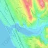
Carlsbad State Beach topographic map

Click on the map to display elevation.

About this map

Name: Carlsbad State Beach topographic map, elevation, terrain.

Location: Carlsbad State Beach, Carlsbad Village, Carlsbad, San Diego County, California, United States (33.14539 -117.35238 33.15603 -117.34407)

Average elevation: 9 m

Minimum elevation: -2 m

Maximum elevation: 54 m

Other topographic maps

Click on a map to view its topography, its elevation and its terrain.
Makusah

United States > California > San Diego County > Carlsbad

Average elevation: 32 m

Gear up for your next adventure:

🚲Bike Repair Kit - Essential tools for on-trail mechanical issues
🧭Orienteering Kit - Tools for map reading and navigation in the wild
🥫Freeze-Dried Meals - Lightweight, high-calorie nutrition for multi-day treks
🧭GPS Tracker - Track your location in remote areas safely
💧Hydration Pack - Hands-free hydration system for long hikes

As an Amazon Associate, this site earns from qualifying purchases at no extra cost to you.