Geolocate

Malvan topographic map

Click on the map to display elevation.

About this map

Name: Malvan topographic map, elevation, terrain.

Location: Malvan, Malvan Taluka, Sindhudurg, Maharashtra, 416606, India (16.02064 73.42695 16.10064 73.50695)

Average elevation: 20 m

Minimum elevation: 0 m

Maximum elevation: 153 m

Other topographic maps

Click on a map to view its topography, its elevation and its terrain.
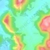
Dikwal

India > Maharashtra > Malvan Taluka

Average elevation: 103 m

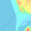
Tarkarli beach

India > Maharashtra > Malvan Taluka > Tarkarli

Average elevation: 11 m

Gear up for your next adventure:

🧤Insulated Winter Gloves - Heavy-duty protection for sub-zero Canadian adventures
🧥Waterproof Pants - Keep dry during rainy hiking conditions
🥾Lightweight Hiking Shoes - Comfortable shoes for day hikes
🔋Solar Power Bank - Keep your GPS and devices charged during long outdoor trips
🛏️Sleeping Bag - Warm and compact sleeping bags for outdoor camping

As an Amazon Associate, this site earns from qualifying purchases at no extra cost to you.