
Taco topographic map
Interactive map
Click on the map to display elevation.
About this map
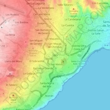
Name: Taco topographic map, elevation, terrain.
Location: Taco, Santa Cruz de Tenerife, Canarias, 38108, España (28.40676 -16.33978 28.48676 -16.25978)
Average elevation: 298 m
Minimum elevation: 0 m
Maximum elevation: 750 m