Geolocate

Turbina topographic map

Click on the map to display elevation.

About this map

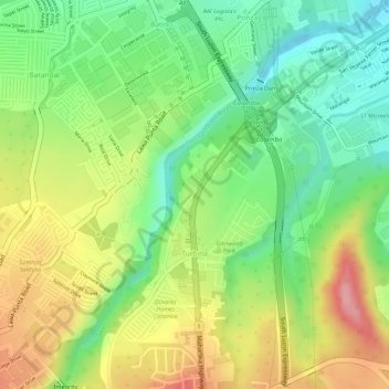
Name: Turbina topographic map, elevation, terrain.

Location: Turbina, Calamba, Laguna, Calabarzon, 4027, Philippines (14.18167 121.13308 14.19499 121.14283)

Average elevation: 81 m

Minimum elevation: 20 m

Maximum elevation: 152 m

Gear up for your next adventure:

🧴Outdoor Sunscreen - High SPF protection for high-altitude UV exposure
🩹Compact First Aid Kit - Pre-packed essentials for common trail injuries
🧳Compression Sacks - Maximize space in your backpack by shrinking gear
🔦LED Headlamp - Hands-free lighting for early morning starts or late finishes
🥤Collapsible Travel Cup - Saves space and weight in your mess kit

As an Amazon Associate, this site earns from qualifying purchases at no extra cost to you.