
Thank you for supporting this site ❤️
Make a donation
Make a donation
Gear up for your next adventure:
As an Amazon Associate, this site earns from qualifying purchases at no extra cost to you.
Balçıkhisar topographic map
Click on the map to display elevation.
Thank you for supporting this site ❤️
Make a donation
Make a donation
Gear up for your next adventure:
As an Amazon Associate, this site earns from qualifying purchases at no extra cost to you.
About this map
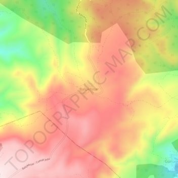
Name: Balçıkhisar topographic map, elevation, terrain.
Location: Balçıkhisar, Osmaneli, Bilecik, Marmara Region, Turkey (40.29867 29.94923 40.33867 29.98923)
Average elevation: 614 m
Minimum elevation: 337 m
Maximum elevation: 796 m
Thank you for supporting this site ❤️
Make a donation
Make a donation
Gear up for your next adventure:
As an Amazon Associate, this site earns from qualifying purchases at no extra cost to you.