Geolocate

Hurley topographic map

Click on the map to display elevation.

About this map

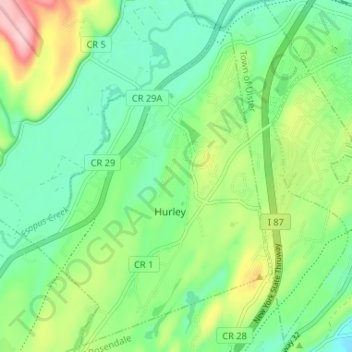
Name: Hurley topographic map, elevation, terrain.

Location: Hurley, Town of Hurley, Ulster County, New York, United States (41.89074 -74.08983 41.93937 -74.02920)

Average elevation: 80 m

Minimum elevation: 18 m

Maximum elevation: 213 m

Other topographic maps

Click on a map to view its topography, its elevation and its terrain.

Bearsville

United States > New York > Ulster County > Bearsville

Average elevation: 284 m

Gear up for your next adventure:

🏕️Camping Hammock - Integrated protection for sleeping between trees
🕶️Polarized Sunglasses - Protect your eyes with durable polarized lenses
🪜Heavy Duty Carabiners - Multi-use clips for securing gear to your backpack
Camping Coffee Maker - Brew fresh coffee anywhere on the topographic map
🚑Survival Whistle - Signal for help across long distances in mountains

As an Amazon Associate, this site earns from qualifying purchases at no extra cost to you.