
Thank you for supporting this site ❤️
Make a donation
Make a donation
Gear up for your next adventure:
As an Amazon Associate, this site earns from qualifying purchases at no extra cost to you.
Maestro topographic map
Click on the map to display elevation.
Thank you for supporting this site ❤️
Make a donation
Make a donation
Gear up for your next adventure:
As an Amazon Associate, this site earns from qualifying purchases at no extra cost to you.
About this map
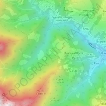
Name: Maestro topographic map, elevation, terrain.
Location: Maestro, Chignolo d'Oneta, Oneta, Bergamo, Lombardy, Italy (45.84952 9.81094 45.86952 9.83094)
Average elevation: 840 m
Minimum elevation: 535 m
Maximum elevation: 1,400 m
Thank you for supporting this site ❤️
Make a donation
Make a donation
Gear up for your next adventure:
As an Amazon Associate, this site earns from qualifying purchases at no extra cost to you.