Geolocate

Clarksville topographic map

Click on the map to display elevation.

About this map

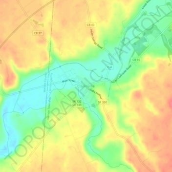
Name: Clarksville topographic map, elevation, terrain.

Location: Clarksville, Clinton County, Ohio, 45113, United States (39.38145 -84.00132 39.42145 -83.96132)

Average elevation: 269 m

Minimum elevation: 235 m

Maximum elevation: 297 m

Gear up for your next adventure:

🗺️Topographic Maps - Detailed maps to explore trails, mountains, and wilderness areas
🥘Camping Cookware Set - Compact nesting pots and pans for trail cooking
🥾Mountaineering Boots - Supportive boots for climbing and high-altitude hiking
🛶Waterproof Dry Bags - Keep electronics and clothes dry during river crossings
Lightweight Camping Tent - Portable shelter optimized for Canadian backcountry camping

As an Amazon Associate, this site earns from qualifying purchases at no extra cost to you.