Geolocate

Palinda-Nuwara (Baduraliya) DS Division topographic map

Click on the map to display elevation.

About this map

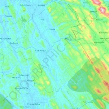
Name: Palinda-Nuwara (Baduraliya) DS Division topographic map, elevation, terrain.

Location: Palinda-Nuwara (Baduraliya) DS Division, Kalutara District, Western Province, Sri Lanka (6.39545 80.16221 6.62244 80.38127)

Average elevation: 151 m

Minimum elevation: 3 m

Maximum elevation: 892 m

Gear up for your next adventure:

🧥Fleece Jacket - Warm and lightweight jacket for layering
🥾Trekking Poles - Adjustable trekking poles to reduce knee stress and improve stability
🎒Hiking Daypack - Lightweight and durable backpacks for day trips and excursions
👖Convertible Hiking Pants - Zip-off legs to adapt to changing weather conditions
Camping Coffee Maker - Brew fresh coffee anywhere on the topographic map

As an Amazon Associate, this site earns from qualifying purchases at no extra cost to you.