Geolocate

Badiyakot topographic map

Click on the map to display elevation.

About this map

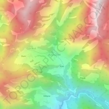
Name: Badiyakot topographic map, elevation, terrain.

Location: Badiyakot, Kapkot, Bageshwar, Uttarakhand, India (30.09173 79.82416 30.13173 79.86416)

Average elevation: 2,482 m

Minimum elevation: 1,730 m

Maximum elevation: 3,238 m

Gear up for your next adventure:

🥾Waterproof Hiking Shoes - Durable shoes for wet and rugged trails
🌡️Emergency Mylar Blankets - Compact thermal protection for unexpected nights outdoors
🥾Trail Hiking Boots - Supportive boots for rough trails
🧳Compression Sacks - Maximize space in your backpack by shrinking gear
🦶Anti-Blister Balm - Prevents friction and hotspots during long ascents

As an Amazon Associate, this site earns from qualifying purchases at no extra cost to you.