
Eldoret topographic map
Click on the map to display elevation.
Eldoret
Eldoret is a principal town in the Rift Valley region of Kenya and serves as the capital of Uasin Gishu County. The town was referred to by white settlers as Farm 64 and colloquially by locals as 'Sisibo'. As per the 2019 Kenya Population and Housing Census, Eldoret is the fifth most populated urban area in the country after Nairobi, Mombasa, Nakuru and Ruiru. Lying south of the Cherangani Hills, the local elevation varies from about 2,100 metres (6,900 ft) at the airport to more than 2,700 metres (8,900 ft) in nearby areas. The population was 289,380 in the 2009 Census, and it is currently the fastest growing town in Kenya with 475,716 people according to 2019 National Census.
About this map
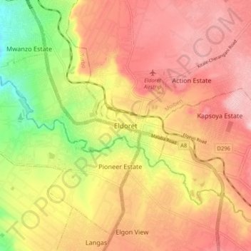
Name: Eldoret topographic map, elevation, terrain.
Average elevation: 2,093 m
Minimum elevation: 1,829 m
Maximum elevation: 2,385 m
Other topographic maps
Click on a map to view its topography, its elevation and its terrain.