Geolocate

Cleves topographic map

Click on the map to display elevation.

About this map

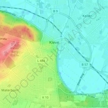
Name: Cleves topographic map, elevation, terrain.

Location: Cleves, Kreis Kleve, North Rhine-Westphalia, 47533, Germany (51.76682 6.10790 51.80426 6.16597)

Average elevation: 39 m

Minimum elevation: 6 m

Maximum elevation: 101 m

Gear up for your next adventure:

🧰Survival Kit - Essential gear for emergencies in the wilderness
🔦LED Headtorch - Bright and durable light for night activities
🦌Outdoor Trail Camera - Monitor wildlife activity near your favorite spots
🔭Outdoor Binoculars - Lightweight binoculars for birdwatching and hiking
🧥Ultralight Puffy Jacket - Maximum warmth that packs down to the size of an orange

As an Amazon Associate, this site earns from qualifying purchases at no extra cost to you.