
Hulubelu topographic map
Interactive map
Click on the map to display elevation.
About this map
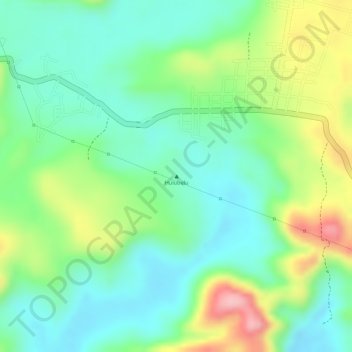
Name: Hulubelu topographic map, elevation, terrain.
Location: Hulubelu, Lampung, Indonésie (-5.35005 104.59995 -5.34995 104.60005)
Average elevation: 719 m
Minimum elevation: 659 m
Maximum elevation: 827 m
Other topographic maps
Click on a map to view its topography, its elevation and its terrain.