
Folhadela topographic map
Interactive map
Click on the map to display elevation.
About this map
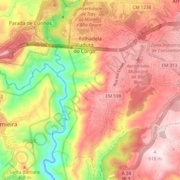
Name: Folhadela topographic map, elevation, terrain.
Location: Folhadela, Vila Real, Portugal (41.24016 -7.75560 41.29119 -7.69891)
Average elevation: 426 m
Minimum elevation: 149 m
Maximum elevation: 615 m
Other topographic maps
Click on a map to view its topography, its elevation and its terrain.