Geolocate

Hoosier Pass topographic map

Click on the map to display elevation.

Hoosier Pass

Hoosier Pass (elevation 11,542 ft (3,518 m)) is a high mountain pass in central Colorado, in the Rocky Mountains of the western United States. The name derives from Indiana, nicknamed the "Hoosier State," which was the original home of many pioneers.

Wikipedia (CC-BY-SA 3.0)

About this map

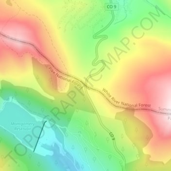
Name: Hoosier Pass topographic map, elevation, terrain.

Location: Hoosier Pass, Summit County, Colorado, United States (39.36183 -106.06268 39.36193 -106.06258)

Average elevation: 3,490 m

Minimum elevation: 3,252 m

Maximum elevation: 3,750 m

Other topographic maps

Click on a map to view its topography, its elevation and its terrain.

Dillon

United States > Colorado > Summit County

Average elevation: 2,796 m

Silverthorne

United States > Colorado > Summit County

Average elevation: 2,858 m

Blue River

United States > Colorado > Summit County

Average elevation: 3,075 m

Gear up for your next adventure:

🎒Backpack Rain Cover - External shield to keep your entire pack dry
💧Reusable Water Bottle - Durable water bottles for hydration on trails
🥾All-Terrain Hiking Boots - Versatile boots for varied hiking conditions
🧥Softshell Jacket - Windproof and breathable jacket for hiking
🚑Survival Whistle - Signal for help across long distances in mountains

As an Amazon Associate, this site earns from qualifying purchases at no extra cost to you.