
Make a donation
Gear up for your next adventure:
As an Amazon Associate, this site earns from qualifying purchases at no extra cost to you.
Hohentengen topographic map
Click on the map to display elevation.
Make a donation
Gear up for your next adventure:
As an Amazon Associate, this site earns from qualifying purchases at no extra cost to you.
Hohentengen
Hohentengen liegt etwa 20 Kilometer südöstlich von Sigmaringen in einer eiszeitlichen Endmoränenlandschaft auf einer Höhe von 594 m ü. NN. Der Landschafts- und Verwaltungsraum, dessen Hauptort Hohentengen ist, wird Göge genannt. Die Gemarkungsfläche umfasst rund 3657 Hektar (Stand: 31. Dez. 2010).
Make a donation
Gear up for your next adventure:
As an Amazon Associate, this site earns from qualifying purchases at no extra cost to you.
About this map
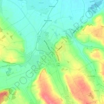
Name: Hohentengen topographic map, elevation, terrain.
Average elevation: 577 m
Minimum elevation: 549 m
Maximum elevation: 622 m
Make a donation
Gear up for your next adventure:
As an Amazon Associate, this site earns from qualifying purchases at no extra cost to you.