
Le Petit Beauvai topographic map
Interactive map
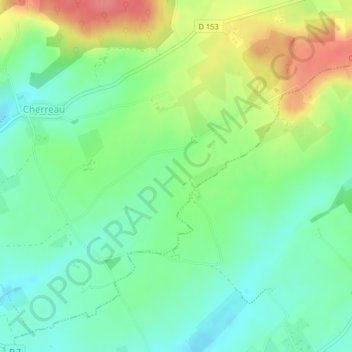
Click on the map to display elevation.
About this map
Name: Le Petit Beauvai topographic map, elevation, terrain.
Average elevation: 137 m
Minimum elevation: 108 m
Maximum elevation: 187 m
Other topographic maps
Click on a map to view its topography, its elevation and its terrain.
Cherreau
France > Pays de la Loire > Sarthe > Cherré-Au
Cherreau, Cherré-Au, Mamers, Sarthe, Pays de la Loire, France métropolitaine, 72400, France
Average elevation: 134 m
Cherré
France > Pays de la Loire > Sarthe > Cherré-Au
Cherré, Cherré-Au, Mamers, Sarthe, Pays de la Loire, France métropolitaine, 72400, France
Average elevation: 101 m